AUTOGYRO SYSTEMS
& APPLICATION SOLUTIONS
Solving Industry-Specific Aerial Challenges
with Autogyro Systems
INDUSTRY APPLICATIONS
Explore how autogyro systems are transforming industries with efficient, flexible, and low-cost aerial solutions.

Agriculture
Precision crop monitoring, spraying, and field analysis solutions for modern agriculture.

Aerial Surveillance
Efficient aerial monitoring for security, border patrol, and large-area surveillance operations.

Emergency Rescue
Rapid deployment for search and rescue missions in challenging terrains and disaster scenarios.
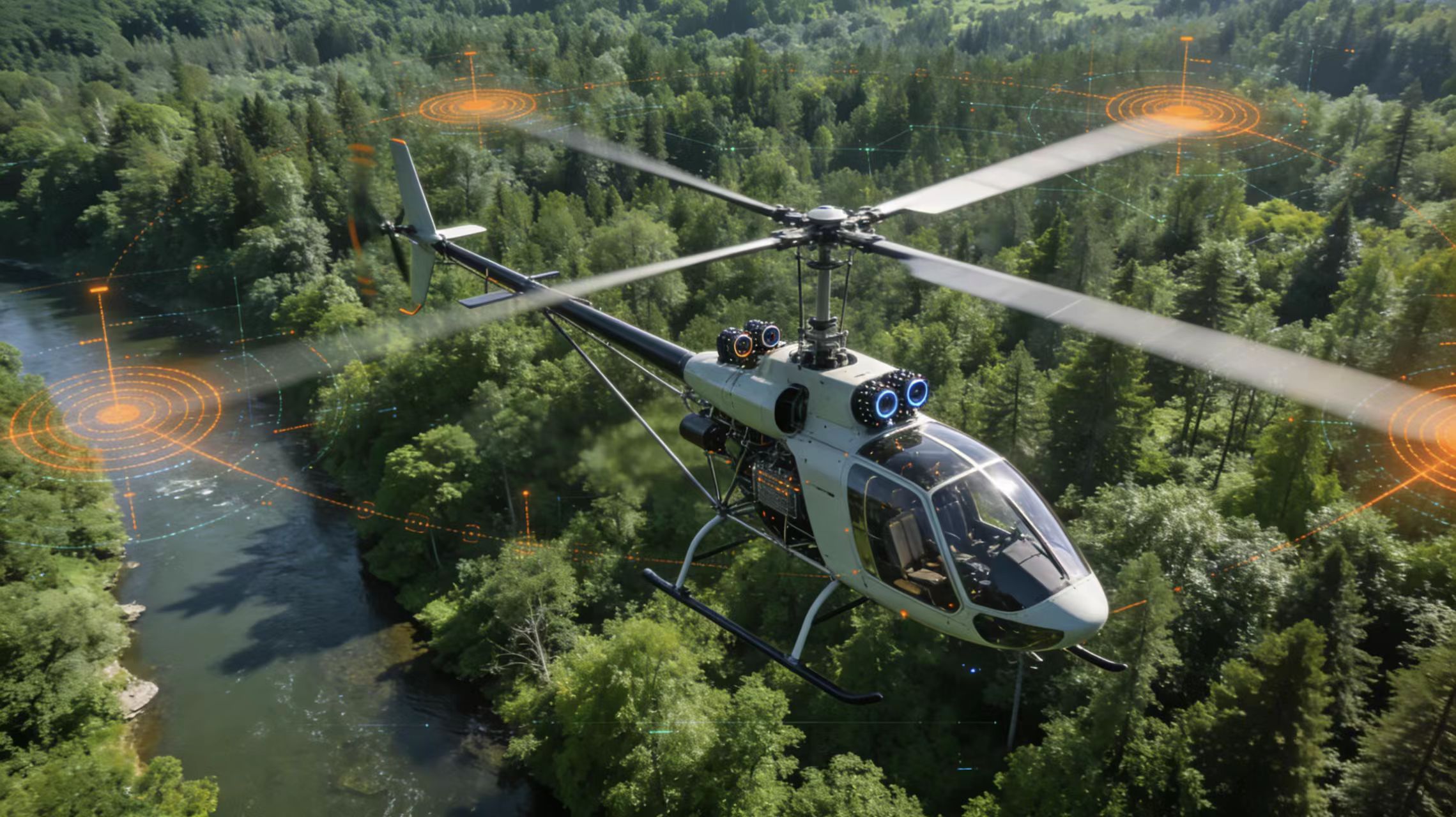
Environmental Monitoring
Real-time data collection for environmental protection, pollution tracking, and ecosystem analysis.

Environmental Monitoring
Real-time data collection for environmental protection, pollution tracking, and ecosystem analysis.

Infrastructure Inspection
Safe and efficient inspection of power lines, pipelines, bridges, and critical infrastructure.
WHY CHOOSE OUR AUTOGYRO SYSTEMS
Advanced aerial solutions designed for efficiency, flexibility, and real-world applications.
OUR AUTOGYRO PRODUCTS
Explore mission-ready autogyro platforms designed for agriculture, surveillance, and mapping applications.

Aerial Mapping
High-precision aerial mapping and 3D modeling for land surveying and urban planning.

Aerial Mapping
High-precision aerial mapping and 3D modeling for land surveying and urban planning.

Aerial Mapping
High-precision aerial mapping and 3D modeling for land surveying and urban planning.
TRUSTED BY GLOBAL CLIENTS
Delivering reliable autogyro solutions to customers worldwide.
READY TO DEPLOY YOUR AUTOGYRO?
Contact us for pricing, customization and global delivery.
Real-World Autogyro Applications
See how our autogyro systems perform across different industries.

Agricultural Operations
Efficient crop spraying, monitoring, and farmland management with high coverage and low operational cost.

Aerial Tourism
Deliver unique aerial sightseeing experiences with safe, stable, and cost-effective flight solutions.

Security & Surveillance
Real-time aerial monitoring for patrol, emergency response, and infrastructure security operations.
Request Pricing & Solution
Tell us your requirements and our experts will provide a customized solution within 24 hours.